

COCONet Science ›
COCONet Science
COCONet Graduate Fellowships
Fellowship Awardees
2013 Regional Data Center Awardees
Science Snapshots and Highlights
Science Snapshots and Geophysical Event Responses
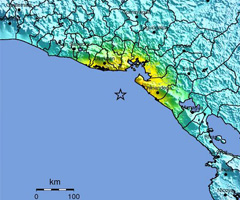
 Science Snapshot: Pinpointing Slip and Earthquake Location with the Guatemalan Geodetic Network
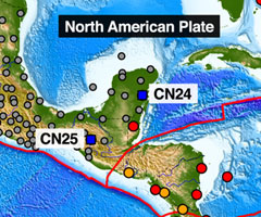
14 June 2016. The 7 November 2012 moment magnitude 7.4 Champerico (Guatemala) earthquake is among a growing number of subduction zone events observed by a local geodetic network.
Read more
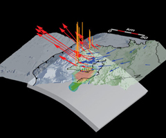
 Science Snapshot: Forecasting Global Earthquakes with Seismic and Geodetic Data
Nov 2015. Forecasting Global Earthquakes with Seismic and Geodetic Data
Read more
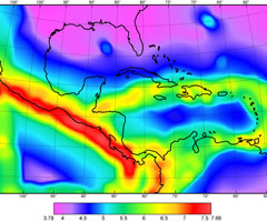
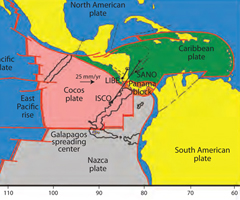
 Science Snapshot: GPS Defines Caribbean Plate in Motion
Sep 2015. A plate tectonic model for the Caribbean is derived using most of the available continuous and campaign GPS measurements in the region.
Read more
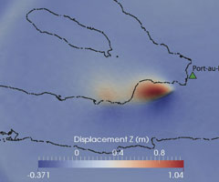 Dynamic Rupture Model for the 2010 Haiti Earthquake
 Mar 2015. The 2010 magnitude 7.0 Haiti earthquake occurred on a secondary blind thrust fault, the Léogâne fault, rather than on the Enriquillo-Plantain Garden fault (EPGF).
Read more
 Data event response to the 14 October 2014 Mw 7.3 earthquake 67km WSW of Jiquilillo, Nicaragua
Oct 2014. In response to the Mw 7.3 earthquake 67km WSW of Jiquilillo, Nicaragua on October 14, 2014, UNAVCO is downloading high-rate GPS data from a total of 25 stations within 1,000 km of the epicenter
Read more
 Anticipating and Monitoring a Large Earthquake in Costa Rica
Jan 2014. The Nicoya Peninsula along the west coast of Costa Rica has experienced magnitude 7 or larger earthquakes about every 50 years since the mid-1800s.
Read more
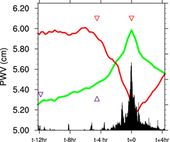 Following Rising Moisture, Clouds, and Rain in the Tropics with GPS
July 2013. Deep convection in the atmosphere, leading to cloud development and precipitation has been directly observed in the tropics of Brazil using a GPS meteorological site. More than 3 years of observations at the station, INPA ...
Read more
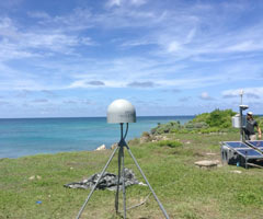
 Island on the Move, Following Plate Motions with Continuous GPS
Dec 2012. Isla del Coco, off the coast of Costa Rica, is the only landmass on the Cocos Plate that sits above sea level and thus the only place where plate motion can be measured ...
Read more
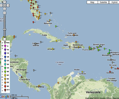 COCONet, a GPS network in the Caribbean, will aid in hurricane forecasts
Sep 2012. COCONet is a network of 50 new continuously operating GPS stations (CGPS), complemented with meteorological sensors and near real-time communications, distributed throughout ...
Read more
Highlights
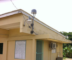
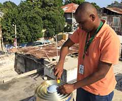 Station Recovery in Haiti
29 August 2016. From July 10th through July 17th, Renaldo Sauveur and Dr. Steeve Symithe from the Central National de I’Information Géo-Spatiale (CNIGS) and
Read more
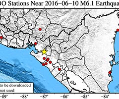 Data Event Response to the 9 June 2016 Mw 6.1 Earthquake 17km E of Puerto Morazan, Nicaragua
22 June 2016. In response to the Mw6.1 earthquake 17km E of Puerto Morazán, Nicaragua on 2016-06-10, UNAVCO downloaded high-rate one-sample-per-second (1-sps or 1 Hz) data from nearby GPS
Read more
 Dataworks for GNSS Software
August 2015. Dataworks for GNSS Software Enables Regional Data Centers in the Central America and the Caribbean as part of COCONet and TLALOCNet
Read more
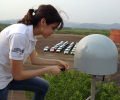
 Anguilla installs
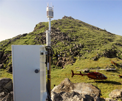
June 2015. UNAVCO installs COCONet cGPS site CN51 on Sombrero Island, Anguilla
Read more
 Antigua and Barbuda upgrades
Feb 2015. UNAVCO installs COCONet cGPS site CN01 and upgrades sites BGGY and CN00 in Antigua and Barbuda
Read more
 Venezuela installs
Feb 2015. UNAVCO installs COCONet cGPS sites CN39 and CN41 in Venezuela
Read more
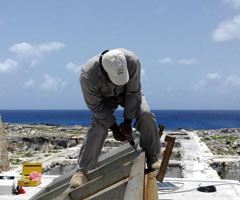
 Honduras install
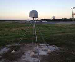
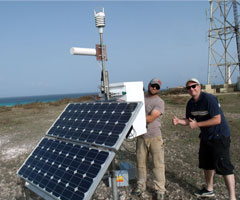
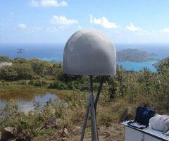
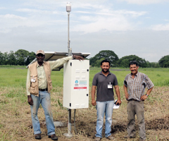
 Dec 2014. Newly installed COCONet cGPS site CN18 on Swan Island, Honduras sits on the edge of the Cayman Trough, far from the Honduran mainland and poised to collect particularly valuable atmospheric and geodetic data because it will provide coverage in a remote part of the world with little data availability.
Read more
 Dominican Republic upgrades
July 2014. Determining how the Caribbean plate moves with respect to the neighboring North America and South America plates has been a major challenge.
Read more
 Honduras
June 2014. Determining how the Caribbean plate moves with respect to the neighboring North America and South America plates has been a major challenge.
Read more
 Carriacou
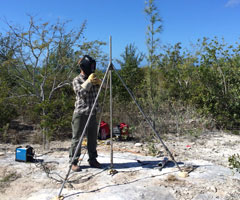
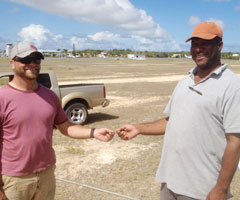
April 2014. While most people in the Caribbean were enjoying their time off for Easter weekend, UNAVCO engineers Jacob Sklar and Michael Fend were installing COCONet GPS site CN46 on Carriacou Island, Grenada.
Read more
 Saint Lucia
Mar 2014. UNAVCO engineers, in collaboration with the University of the West Indies and Saint Lucia’s Ministry of Physical Development, Housing and Urban Renewal, installed cGPS sites CN47 and CN04 in Saint Lucia during a 2.5-week trip spanning February and March 2014.
Read more
 Bahamas
Feb 2014. Determining how the Caribbean plate moves with respect to the neighboring North America and South America plates has been a major challenge. Geologic plate motion models using seafloor magnetic anomaly rates ...
Read more
 Dominican Republic
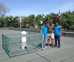
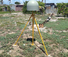
Feb 2014. In collaboration with the Oficina Nacional de Meteorología (ONAMET), Alex Holsteinson at Geomedición, Instrumentos y Sistemas, Fausto Baez at Holasa, and the Punta Cana Group of the Punta Cana International Airport, COCONet GPS site, CN05, has been installed in Punta Cana, Dominican Republic.
Read more
 Jamaica
Nov 2013. A whirlwind four-day trip in September resulted in maintenance of two of the most challenging GPS sites in COCONet. UNAVCO field engineers John Sandru and Michael Fend worked with Paul Williams of the University of the West Indies' Earthquake Unit to upgrade ...
Read more
 Panama
Nov 2013. UNAVCO engineer Mike Fend worked with collaborators to bring Panama sites CN20 and CN28 back online.
Read more
 Trinidad
Oct 2013. UNAVCO worked in collaboration with personnel at UWI, both in the seismic and surveys and lands departments, to complete the new GPS site in Toco, a small town situated along the remote north east coast of Trinidad.
Read more
 Aruba
ArubaOct 2013. By collaborating with the Meteorological Department of Aruba, UNAVCO engineers were able to install another cGPS site in the Caribbean.
Read more
 Roatan
Oct 2013. With assistance from students Jose Eveline, Guillermo Antonio Lopez, Antonia Sarahi Martinez, and Estefania Kury (all of the Universidad Politécnica de Ingeniería (UPI) Tegucigalpa), Honduras, UNAVCO reestablished a continuous GPS/MET site on the island of Roatan.
Read more
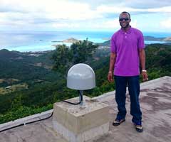
 Anguilla
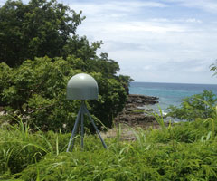
May 2013. With assistance from the Anguillan government, UNAVCO installed a continuous GPS/MET site in Anguilla, one of the most northerly of the Leeward Islands in the Lesser Antilles, lying east of Puerto Rico and the Virgin Islands, and directly north of Saint Martin.
Read more
 Virgin Gorda
May 2013. Collaborating with Jasen Penn at the British Virgin Isands Department of Disaster Management and Jose Cancel at the University of Puerto Rico Mayaguez Campus allowed UNAVCO engineers to have invaluable help before, during, and after the installation.
Read more
 Panama
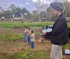
April 2013. A total of 4 new COCONet cGPS and meteorological sites (CN20, CN28, CN33, and CN34) are now operational in Panama.
Read more
 Mar 2013. Mexico
Two sites at the most southern part of the North American continental plate were installed in Mexico.
Read more
 Redonda Island, West Indies
Nov 2012. One continuously operating GPS site was installed on Redonda Island in the West Indies of the Caribbean ocean. The island belongs to the nation of Antigua but its nearest neighbor is Montserrat, located 12 miles due southeast.
Read more
 Colombia
Nov 2012. In August and September of 2012, UNAVCO supported the installation of four new cGPS stations in Colombia.
Read more
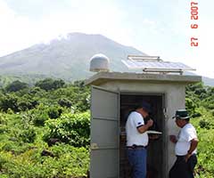
 Nicoya Peninsula
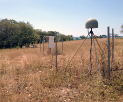
Jan 2012. The Nicoya Peninsula continuous GPS network consists of 18 remote sites distributed mostly in the forearc of the Cocos subduction zone in northwest Costa Rica.
Read more
 Haiti
HaitiNov 2011- Following the earthquake of Jan 2010, 6 CGPS stations were installed in key locations around Haiti to measure the after effects and ongoing activity in the region. Of these 6 stations, only 1 was transmitting data back to UNAVCO reliably by the middle of 2011..
Read more
 Cocos Islands
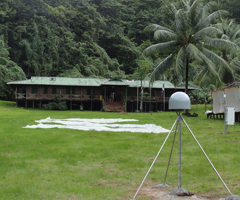
Jun 2011- The first CocoNET continuously operating GPS station was installed in late May 2011 on Cocos Island in the Pacific Ocean, 340 miles off the coast of Costa Rica. The island is located in the middle of the Cocos plate, which subducts below the Carribean plate to the east.
Read more