

Station Info for Caribbean Land-Owners
English | EspañolWHO IS UNAVCO?
COCONet will be installed and maintained by UNAVCO, a Colorado-based non-profit membership-governed consortium that operates GPS networks worldwide. UNAVCO recently completed the installation of the EarthScope Plate Boundary Observatory in the United States, which included the construction of over 875 new GPS stations distributed over the entire country. UNAVCO was funded by the U.S. National Science Foundation to lead the construction, operation, and maintainance of the COCONet observatory.
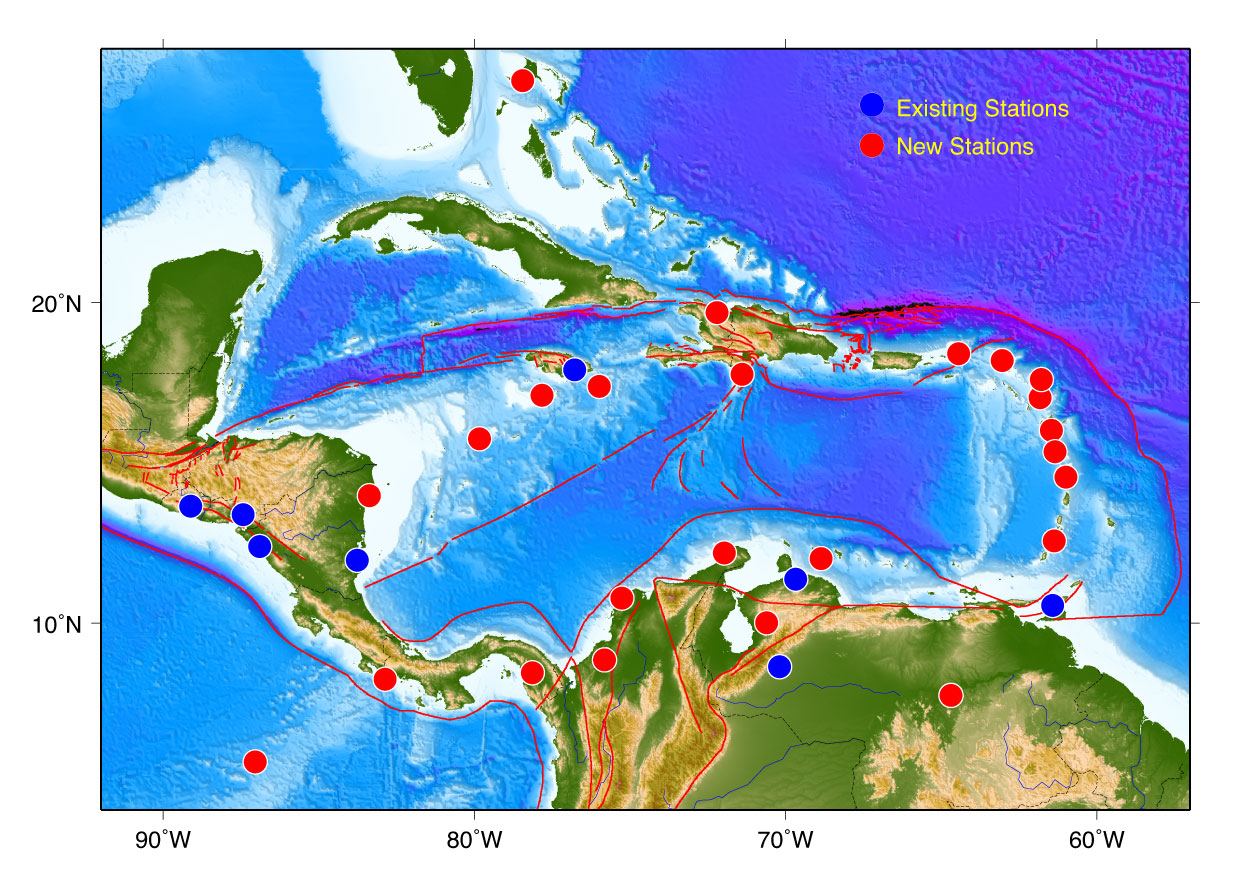 Initial Siting Plan
WHAT IS COCONet?
COCONet will consist of 50 newly constructed continuously operating GPS/weather stations integrated with 50 existing GPS stations operated by partner organizations. COCONet will provide free, high-quality, open-format GPS and meteorological data for these stations via the internet for use by scientists, government agencies, educators, students, and the private sector. These data will be used by local and foreign researchers to study solid earth processes such as tectonic plate motions, tectonic plate boundary interaction and deformation, including earthquake cycle processes and risks. They will also serve atmospheric scientists and weather forecasting groups by providing more precise estimates of tropospheric water vapor and enabling better forecasting of the dynamics of airborne moisture associated with the yearly Caribbean hurricane cycle. Temperature, barometric pressure, wind speed and rainfall data will be collected at each site using an advanced, very compact weather station. Local land surveyors, Government Agencies, NGOs and Humanitarian groups will also be able to benefit from improved weather data and a modern, highly accurate land survey reference frame.
WHAT WILL HAPPEN TO THE DATA FROM THE STATIONS?
GPS and meteorological data will be relayed via cell phone service or satellite internet connection to the UNAVCO Data Center located in Boulder, Colorado USA on a daily basis. The raw GPS and meteorological data will be archived and available for download by anyone. We will also seek out seismic/GPS Network operators and government agencies in the Caribbean region to be local hosts for the GPS and weather data products. Data from COCONet stations will be available via FTP and through UNAVCO’s data portal at http://facility.unavco.org/data/dai2/dai2.html
 Key components of a GPS station
WHAT DOES A STATION LOOK LIKE & HOW DO YOU BUILD IT?
A GPS site typically requires a maximum footprint of 10-by-10 meters depending on the site layout and the number of solar panels and antennas. Sometimes the GPS antenna can be located on the roof of a well-constructed building and the electronics housed inside the building, making the footprint very minimal. The photo on the front shows the key components of a GPS station.
Additional antennas and fencing may be required depending on specific site characteristics. It takes UNAVCO engineers 1-2 days to install a site. Tools such as a hammer drill, a small portable welder, a small generator, and assorted hand tools comprise the equipment for building a site. All steel, enclosures, electronics, antennas and equipment will be shipped to the host country as a kit. A hand dug, shallow trench is needed to bury approximately 25 feet of conduit in to connect the GPS antenna to the electronics enclosure box. Otherwise the only ground disturbance at most sites is drilling 4 small holes 1.5-2.0 meters deep into solid rock and another 5 cm hole for the electronics enclosure box.
HOW OFTEN WILL THE SITE BE ACCESSED BY UNAVCO STAFF?
Typically a station will need to be serviced once every two years. Modern electronics and UNAVCO’s experience in constructing these sites should greatly reduce on-site visits. After major hurricanes or an earthquake, a UNAVCO engineer may be required to visit the site to repair damage. Sometimes the site may require a visit to reset a fuse or clean the solar panels and in these types of instances, UNAVCO welcomes the help of in-country partners. UNAVCO plans to provide training on construction and maintenance to groups that are willing to assist with station hosting.
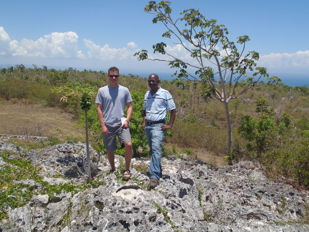 Barrett Friesen (UNAVCO), and Lyndon Brown (UWI - Mona Earthquake Unit), Jamaica
WHAT MAKES A GOOD GPS SITE?
The primary criteria used to evaluate the suitability of candidate sites for these 50 stations are: expected ease of permitting, site security, geologic setting, sky view and multipath, access considerations, data communication strategy, and power availability. Typically, the selected site is a compromise between these competing criteria. An ideal site will have a long-term permit agreement, good security, surface bedrock for the GPS monument, full sky view with no nearby obstructions, easy access by car, cell phone service, and nearby AC power.
WHAT DOES UNAVCO NEED FROM YOU TO MAKE COCONet SUCCESSFUL?
Given that the COCONet will span many countries where UNAVCO does not have formal relationships, we are seeking in-country organizations that will benefit from COCONet to help us identify and secure long term sites for the construction of GPS stations. UNAVCO is willing to enter into Memorandum of Understanding (MOU)-type agreements with groups that can host a GPS site on land that they control or can obtain permission for construction on. It is important that once an installation team arrives in country, site access has been negotiated and all preparations have been made for the team to begin work. UNAVCO would like to be able to ship equipment directly to a host organization and would benefit greatly from any logistical help that can be offered. UNAVCO is willing to pay all direct costs associated with site construction, equipment, shipping, transport, and permitting. UNAVCO has resources to engage host country staff in training, education, and technology transfer. UNAVCO has multi-lingual staff available to assist with creating MOU documents or other types of agreements that may suit different needs.